Monday, October 28, 2013

Drop-bar-pannierd-khakied-skinnytired River Trail

Since I wasn't planning on doing many if any cyclocross races this year, I didn't take lots of long rides after work during summer to whip myself into some kinda shape so I could come in second to last or dfl in the Masters race.  But holy cow we've had some great September-October weather that I thought I better take advantage of now.  Haven't done any dirt riding after work for a long time so last Thursday took the Centennial Trail to Sandifur Bridge to the cemetery and hit the River trail on the Vaya in dockers and a t-shirt, with a single rear pannier bag.  Beautiful warm sunny day. Relatively skinny 40mm tires.  Other bikers rock the drop bars here and the Vaya handles the trail pretty good, but for the rocky parts I do better with wider mountain bike or cross style tires.  Did a little walking.

forthwith some pictures.


I couldn't believe I haven't taken the Pugsley N/R on this trail yet, so Sunday headed out and rode it out and back. Really nice being able to roll over rocks sometimes instead of navigating between them.

Looks like there was a work party out sometime between Thursday and Sunday below the housing development, as pine needles were swept away and the trail leveled and widened in spots.  And a sign I haven't noticed before:


Forgot to take the rear light off before I hit the trail, and it went missing somewhere in Riverside State Park. The cardinal sin of mountain biking.

Thursday, October 24, 2013

Post Street Solution

To get bikes from Riverfront Park to the Monroe St. underpass/Centennial Trail connection, there is a 2-way bike lane in the works on the east side of the Post St. Bridge.


The middle of the street is a one-way running north.  The bike lane crosses this at an angle, with a stop sign for the bikes.

It's an interesting solution. Not sure if if like this angled crossing, with no stop sign for the vehicle lane. I usually ride in the traffic lane now, the bike lane can get crowded with people walking. I have a feeling when it's open to traffic, I might still ride in the one-way lane, especially if I'm heading further north on Lincoln instead of turning left.  Depending on the speed and volume of traffic.

The underpass is a great way to get by Monroe Street and continue on the Centennial Trail.


West of Monroe:


Back on Post Street, lots of construction activity going on where the new park/plaza is going in south of City Hall, and Post reconfigured.  The first time I looked here, I was startled how much this has opened up the view.


These projects should look real nice when finished.  Hoping it works for bike, foot and motor traffic.

Monday, October 21, 2013

All Kitted-Up

I only first heard the term 'kit", meaning a bike racers outfit, a few years ago.  Probably about the time I started cyclocross.  Then I heard the term kitted up.  Some months ago a guy writing into a Bicycling magazine said something about how his son wanted to go on a bike ride, and he hesitated a bit because he'd have to get kitted-up. What a pain I thought. I like to be able to hop on the bike without too much hassle.

Then my smugness faded away as I realized I'd just gone on a bike ride on gravel and dirt in my own version of "kitted up", it being late winter:

headless biker and dog butts ..my great photo skills
Looking dorky as usual. (The knickers are from Aero Tech, the fit is kinda strange.  These are size mediums with a lot of room in the adjustable waist. Usually wear 32-33 jeans. Came across this brand at the Seattle Bike Expo a few years ago. Not sold on them).

Then there's the Partial-Kitted Up version.
REI 3/4 hiking pants, REI button-up bike shirt, 5-Ten platform MTB shoes (another item not from REI, shockingly) but somewhat normal clothes.

And the Bike Commuting kit:

I guess not really a kit, as it consists of my work jeans (or dockers depending on the day) and a T-shirt. I can ride to work, change shoes and put a polo or button-up over the t-shirt and I'm presentable and within corporate dress guidelines. Trying not to feel too smug.

Riding in normal clothes - as you probably know, a big deal in some bike circles.  I try not to put too much into it or join the great debate over riding in lycra/bike specific or regular clothes. Never liked tight clothes or polyester, so I tend towards the normal clothes spectrum with some adjustments. It depends on the type of bike ride.  Heading to the store or barber - no change. Heading out for long dirt/gravel/road ride - might require a change, if I'm not already in shorts and t-shirt.


Friday, October 18, 2013

A Little Urban Single Track

Part of my never ending quest to vary my ride home. At the end of Nettleton just south of NW Blvd - the park/wild area at the corner of TJ Meenach Dr/NW Blvd. And fantastic bike riding weather.


Sunday, October 13, 2013

last week sunday pugsley ramble


Not sure exactly where I went but this is as near as I can make it...down Merkel to Riverside Park Bowl & Pitcher area, across Centennial Trail up Trail 210, south on Trail 25 I think, across W Trails Rd on another trail, on what looked like old RR grade in spots, came across road thought was Houston but it wasn't and dead-ended, rode along working RR tracks, found Houston, stayed away from the Archery range, to the Military Cemetery, Trail 100 (?) along the ridge, lots of horse crap (you have to pick up after your dog but not your horse I guess) which made me think maybe I was in the "no bikes preferred" equestrian area by accident.  Didn't see any horses but I thought might be on the same trail that is marked "no bikes" to the left of the swinging bridge. Sure enough that's where I arrived back at Bowl & Pitcher, Trail 25. A few pics


interesting house up in the hills

off Houston...some type of old walkway?

 ...bout ready to sell my mountain bike as I like riding the Pugsley N/R better, it goes anywhere. Except I need the mountain bike for studded tire commuting. But I could replace both the mountain and cross bikes with a Fargo or Fargo type vehicle, then the Fargo could be the studded tire commuter.  There's always something, but I'd like to condense the bikes down.

Friday, October 11, 2013

Yet another way home (Howard Street to Montgomery Ave to Cedar to...)

The short story version: From downtown go north on Howard, turn left on Montgomery (be careful in 2 blocks at Post & Montgomery) keep going on Montgomery across Monroe, turn right on Cedar after Trinity School & Church, turn left on Grace, then right on Nettleton where you can turn left on Dalton or up to Longfellow and find your way home.

longer version with pics from last month:
one of my usual ways home takes me north on Elm St to arrive at NW Blvd between Pizza Hut and a schoolyard.  There's a painted crosswalk here with concrete islands in the middle that offer a little refuge halfway across.


I try to hang back here and wait for traffic to clear in both directions before crossing, but I get impatient sometimes.  I'll get my front wheel close to the curb to encourage cars to stop; or start across when the eastbound traffic is clear but westbound isn't. But then one car will stop, the other lane will keep going, or drivers will slam on their brakes because the car in front of them stopped and they weren't expecting it.  (It's like this crosswalk appeared overnight.) So I try to avoid that.

I rode home from work with my wife a few times this summer, and she didn't like to cross here. So she found us another way. To avoid NW Blvd, I some times go up Howard St and Post all the way to the hill below Garland, then go over to cross Monroe by Skippers, but traffic can be heavy there also. There's no stoplight for a long stretch on Monroe to break it up. There is a light just a some blocks north of NW Blvd/Indiana but I could never remember what street it is, and I usually couldn't find it from Howard.

Debbie found it - it's Montgomery, and it turns out it offers an easy way to cross Monroe and get to Maple/Ash.

Up Howard:

Left on Montgomery:


Two blocks to Post.  I have to be careful here because the stop sign is hidden behind tree leaves. Approaching the intersection the first few times I missed it and just thought it was another uncontrolled lightly used street; but it's a North/South arterial. 

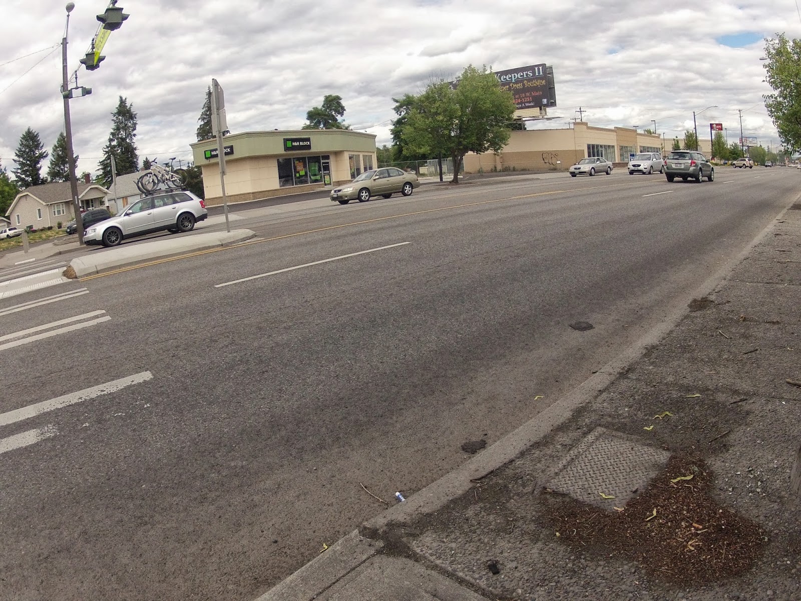
Keep going until Monroe.  I think a bike will trigger the stoplight sensor in the street here, but I usually go over and push the crosswalk button just in case. It doesn't seem to help. Either way it's a long red light on weekdays.

Stay on Montgomery until Trinity School/Church and turn right on Cedar:
it was a nice september day

On Cedar.
 Left on Grace:
That's Maple up ahead. Or Ash, I can't keep them
straight, easier to just call them the one-ways.
This route trades crossing busy 5 lane NW Blvd, for crossing busy 2 lane Maple & Ash. It's another opportunity to learn patience.  Which is difficult for me, but I'm getting better at it. Just wait for traffic to clear. But damn the arterials in town are all designed to keep vehicle traffic flowing, and not for motor and human powered vehicles or walkers to cross.


After the One-Ways, I'll head up Nettleton and then take my pick of the dozen or so ways to get home in the west Shadle neighborhood. Usually turn left onto Dalton to cross Cochran & Alberta.

Meandered around Audubon Park

The only thing I didn't like at first about this route were all the uncontrolled intersections on Montgomery and Cedar.  I don't know why it bothered me as it's not much different than other routes around town in that regard.

Monday, October 7, 2013

Weed Report: Columbia Plateau Trail


Thick and tall just past Lamont. Botanically speaking, I don't know if these are classified as weeds, or native plants/flora or even what the difference is.  I'll have to look into that. I call them either weeds or tules.  Whatever they are, they're a bit in the way.

A conference/vacation for the week of Sept. 22 fell through so I found myself with a few days off with no plans.  Sure, I could get some things done around the house, but there's always time for that in the future.  Originally, I planned on heading out on the trail and do an overnighter to see how far I could go in a day.  But then I don't know what got into my head and I scrapped that, just went out for a recon on the railroad rock to see how close to Washtucna I could get on a semi-loaded fatbike.  Shouldn't have listened to the weather people.

I started at the Martin Road Trailhead, knocking about 20 miles off from the start in Cheney.  Didn't take too many pics on the way.  There's a short, swampy section of overgrowth just before Lamont that I thought I could ride through, but it caught me off guard and I quickly came to a stop.  I thought the water was from the rain the night before, but this swamp might be a regular feature. There are tules/cattails on both sides of the trail here. I tried to push my bike through but sank into the mud up to my ankles. I don't know what happened to the railroad rock in this section, maybe it's buried under the mud. And it stank.  Might've been a combination of mud and cow manure, or whatever swamp gas is composed of.

Some pics further down the trail.

The bridge over the John Wayne Pioneer Trail

looking east-southish

west-northish over the JWPT

last pic before I turned around about 23miles from Martin
Rd Trlhd. Think a few miles from Benge
Saw lots of deer, owls. One coyote. And a porcupine that scrambled up a rock cliff but couldn't get any further up it.  So he stopped with his tail pointed at me.  Had me a little concerned, but I made it safely by. No wildlife pics, sorry.


As I got near Lamont on the way back I started looking for a way around the overgrown section, and turned right on a road (McFaddon Rd or near McFaddon Rd according to my GPS Topo map, unnamed in Google and DeLorme atlas) that led to the Lamont Rd/McCall Rd intersection. I hopped off the trail and took Lamont Rd.  Before I reached Lamont, I took Revere Rd to this little wooden bridge over the trail.  On the way out, I'd been startled to look back and see someone standing on this bridge watching me as I pushed the Pugsley NR through the tules.


Next time on the way out, I'll probably leave the trail at the Lamont grain elevator and take Lamont Rd to skip this section.  That will only have the shorter, swampy section to get around/through before Lamont.


I didn't hit a bad headwind on the way back like before, but by the time I got back to the Martin Rd I'd had enough of the trail. Texted my wife and told her I was over the trail.  Didn't want to see it again.

But you know...I'd spoken to Eric E. before I left. He was thinking of doing an overnighter in October. Possibly can get a day off later this month and go, too.  But the wheels are still turning...I'm thinking a 2-3 day trip should be enough time to make it to Pasco.  Maybe take the train back if possible or get a ride back.  Pencilled in for next year.