Sunday, December 26, 2021

Belsby Road and Whatnot

Well look what I found in my drafts - a one sentence post started Oct 30 about a ride in mid-september! I’m going to do my best to finish it and get another post up before the new year.

I headed out to the Martin Road Trailhead on the Columbia Plateau Trail for the first time in ages one fine overcast day. It’s about a 35 mile bike ride there from the Fish Lake Trailhead in Spokane: https://ridewithgps.com/routes/ (been playing with the route maker in Ride With GPS). This makes for a good weekend bike camping trip. I was only doing a day trip and didn’t feel like biking 100-plus miles so I drove out there.

My plan was to ride an almost-loop route on the gravel roads in the area that I figured out by looking at my handy DeLorme Atlas and using the RWGPS route maker: take one of a couple ways down to Belsby Rd, turn left onto Long Rd to begin the loop back, then left on W Martin Rd, another left onto one of the dirt sections of Mullinex Rd and back. See: https://ridewithgps.com/routes/37614494. Despite what RWGPS says, this is almost all gravel/dirt roads.


So that was the plan. After parking at the vacant trailhead, I headed out with a backpack on my back and a few provisions. I said hello to a few bulls just a short distance from Martin Road, with the Columbia Plateau Trail in the background. I’m not 100% certain now that they were bulls, but I was glad they were behind a fence. One time I was out here and rode by some free range cattle just as they were crossing the road, which gave me just some mild concern. Bulls are something else, at least the farm kids I grew up with said so.


The first few miles or two were tough - the road wasn’t bad, but I was out of shape and had been mostly riding short rides on city streets to work back and forth. A nice view:

I’m a sucker for old abandoned buildings and thought of getting closer to this one and exploring it.


Suddenly I had a sinking feeling. My back felt awful light. No weight on it. Oh crap! Where’s my backpack? With my keys, wallet, and $60 cash? Aargh! I must’ve left it on the ground when I first stooped to get a pic and took out my camera. I turned around and hastily backtracked. I pedaled fast and got a good workout. I’d seen a couple vehicles passing the other way and hoped they hadn’t stopped to pick it up. I finally turned a corner and could barely make out a lump in the road. I think that’s it!


Whew, yes it was and complete with keys, wallet, and cash. By then I was a little worn out, and ditched finishing my planned ride. I headed back to my truck, stopping to visit with some cattle.

I like riding these roads south of Cheney and wish they were closer to Spokane. I think next year I will finally tackle the Palouse to Cascades Trail again, especially since the Beverly Bridge will be completed. If I start in Spokane instead of taking the train to Seattle, I’ll ride the Fish Lake Trail to Martin Road then down Belsby to connect with the P2CT. Alternate plan is to do an out and back of the eastern section only.

In the meantime. here’s another loop I made to explore: https://ridewithgps.com/routes/37902382.


Tuesday, June 29, 2021

Fran Gondo Ephrata Addendum and more odds and ends

Hey, are you still there? Here’s a screen shot of my Ride with GPS fondo route:

And the actual route:
I really didn’t bike helicopter over and skip a significant portion of the route. 

I lost my Garmin Edge Touring model a few years ago after a GFE. It probably fell off the back of my truck where I probably set it and then drove away. I haven’t felt worthy enough to replace it yet because why if there’s a good chance I’ll do something similar lose it again? So I downloaded the route in Ride With GPS and used my phone. And then as you see, I lost the signal on Baird Springs Road. 

I like seeing my speed and elevation on a garmin type device as I’m biking but I found I enjoyed biking the GFE course without the device on my handlebars, not knowing how far along we were on the route, how many more miles to go. It can be demoralizing to look at the garmin when you’re tired and hungry and see - aaack 35 miles to go I’m not even halfway. I kept my phone in my pocket, so even after I picked up the signal again I didn’t know where we were. It’s freeing to just pedal and enjoy the ride without constantly checking progress, or speed, or temp, or elevation or all the other stats to obsess over. The route was well marked and an easy one to follow so I didn’t need turn by turn directions. Someday I’ll get another Garmin or other brand, but for now I’m ok without one. 

And that reminds me, I managed to make 3 water bottles last the 50 miles because I really don’t like drinking out of those bike squeeze bottles. It’s tough to get much water at a time so I often stop, take the lid off and take a big gulp. And besides, the caps - especially the camelback style - get gross and groady. Does anybody make a style with a little flip opening? you know, like the plastic lid to a styrofoam truck-stop coffee cup? Be right back while I go search for one.


Nah, I didn’t find one. Maybe I can learn to 3d print and make my own.

I get the radwagon out now and then, here and there, not everywhere. It’s a beast, I’ve been eyeing those little Tern folding e-cargo bikes but yikes the price! I’ve also been covetously eyeing the newer slightly smaller radwagon. My gen1 gets the job done, I guess I’m happy or at least ok with it. I cleverly titled this pic “From the not-so-rad-mart to the rad-wagon to the rad-garden”


My first bike in the rain commute in ages! May or June in one of our torrential downpours we get occasionally. I took the fenders off last year and haven’t put the fenders back on since I started biking to work downtown again. I knew some day it’d rain again but I like the unfendered look.


Can you say orangeburg pipe? 


A trip to the hardware store. I’ve been thinking of going back to rear rack and panniers.What someone needs to make is a rear rack with a flat platform like a pizza rack but compatible with panniers, too.

Oh I forgot, this is Dash’s kitty friend from a few blocks away. S/He greeted me on my way home one day.

Centennial Trail pics: Summit Gap trail work, new trail from Carlson Trailhead to Sontag Park


Front and back yard nature pics.


I’m sure I can find more photos to dump, but that’s enough for now.


Monday, April 12, 2021

Half-Pint Gran Fondo Ephrata

I had just about decided to skip this year’s Gran Fondo Ephrata on March 27 when bike buddy Arnold, who I rode it with a few years ago, texted and said he had just signed up for the 45 mile Medio 9:40am Saturday start. Darn! I’m not up to this, I’ve only ridden more than 20 miles at a time a few times this year, max 30 miles and on mostly flat land. Nothing close to 45, and I’m not bike commuting 9 miles a day which is usually enough to get me half-ready for a long ride. But I said ok, I’m in. I am walking our dog, Dash, every day on lunch and weekends, I hope that helps.

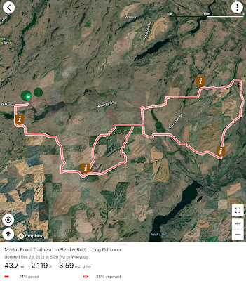
I had signed up last year for the 80 mile ride (or Grande), which got cancelled, and gladly moved down to the minor leagues and signed up for the half-pint route, a still formidable challenge with plenty of climbing. I would miss out on one of my favorite parts of the Grande, the Baird Springs Road downhill, but still get to do the fast Sheep Canyon Road as both routes converge towards the end on it. 

I stripped down my Salsa Vaya and removed the fenders, pizza rack, and Swift Zeitgeist saddle bag. I switched out the Wolf Tooth Half Bottle Adaptor with the B-RAD Double Bottle Holder from my camping Fargo so I could carry 3 bottles within easy reaching distance. Sharp-eyed readers who know their bottle cages will notice I have a left Lezyne side-mount bottle holder on the right sidedown. That’s a long story*. It doesn’t make much difference, it’s still easy to pull the bottle out; also, I often stop for a break to take gulps of water with the lid off.

I pulled into town Friday night, got a double Dusty Cheeseburger with onions, fries and shake, then checked into the Best Western at the south end of town. It’s just a few blocks from the old homestead where my 90+ mother still resides. She’s had both her COVID vaccine shots, and I’ve had my first but I figured I’d play it safe and not stay overnight.

The 9:40am start had a full complement of bikers and 25 of us hit the pavement, heading out of town up Sagebrush Flats Road. Our route bypassed the Johnson Canyon climb of the 80 mile route seen below. I didn’t really miss it.

We had our own climbing to do, and continued up Sagebrush Flats Rd. The Vaya sure felt good without the racks and fenders on it. And with 46/30 crankset up front and 11-36 cassette in back, the climbing was better than years past. But it wasn’t long before I was off the back. 

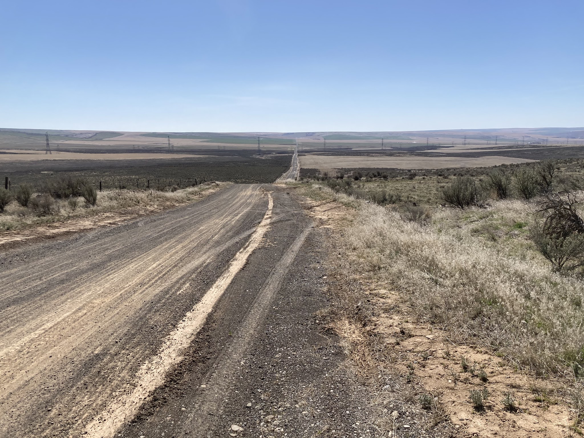
Then onto the gravel, still climbing. This is where the riders from the next wave started catching up and passed us. [ed. note: here begins the less talk, more pics section of the blog.]


And the next wave. And so on. 
Also, Primitive Road sign, getting into the good stuff. 

A welcome downhill section. whoa, out of focus.


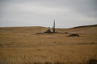
Peak elevation, maybe.

Arnold, motoring along.


I believe this is heading down towards the half-way mark and the snack station (it could also be on the 2nd half of the route, that’s what I get for taking a couple weeks to finish this post). After the snacks, there was some boring pavement riding that went past the Rimrock Meadows community about 16 miles northwest of Ephrata. 

A couple of times on these downhill gravel sections the tires slipped a bit, and I second guessed my decision to go with the 47mm wide smooth Teravail Rampart tires. Or maybe I should’ve stopped and let some air out of the tires. Those slippery times I also remembered I forgot, again, to sign up for the emergency helicopter ambulance service offered by Life Flight. Only $69 a year for you, your spouse or domestic partner, and dependents.

Woo-hoo, rollers.

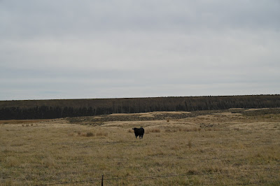
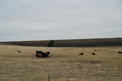
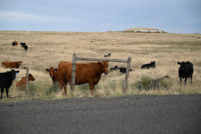
We biked past tons of wheatland, so I stopped to take pics of remnants of the sagebrush-steppe or brushsteppe land when we came across some. It’s habitat for sage-grouse and pygmy rabbits, rattlesnakes, jackrabbits, deer, antelope, and assorted other critters. 


I looked down and saw my mask was acting like a drag-chute.

Back on gravel, and another fun section.

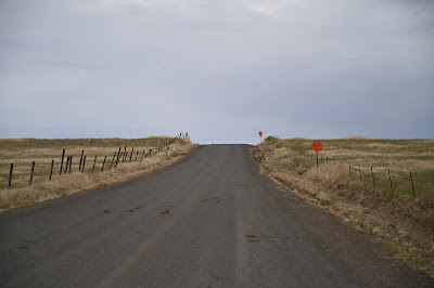
A most welcome sign, Sheep Canyon Road. Only trouble is it’s about another mile of up and down climbing to get to the fast paved downhill section. 


I didn’t feel like I went as fast downhill on Sheep Canyon as years past and the bike didn’t want to go faster. Maybe I was more cautious, or didn’t get in a good aerodynamic position, or the 47b tires were slower, or maybe a brake was rubbing. Still fun. I finished off my 3rd bottle and headed into town for the last few miles. 

Neither Arnold or I were quite sure when we started if we’d be able to finish the route, but we did. I joke about the Medio being a half-pint or minor league ride, but it’s a full-fledged ride in its own right and worth celebrating. 

With a nap in my case. I biked to the motel on the other end of town and snoozed for a bit before getting dinner with mom, brother, and nieces.

[insert abrupt ending to blog post here]

* I had an extra left side bottle cage that I put on the right side of my Vaya awhile ago, and then before the fondo I borrowed a right side one from a Fargo and found another left and put it on the seat tube. I guess I could’ve pulled the left-side one off the right and then put them on their proper spots, but that’d would’ve been an extra step. I’ll get around to it someday, maybe after I finish turning my Marin Muirwoods into a single-speed (or 2x10, still going back and forth on that).


Sunday, March 7, 2021

Slim Pickin’s

still working from home but i try to get out on the bike a couple times a week, some weeks maybe just once. a couple 15-20 milers on the weekends. luckily, i walk our dog dash most every day on lunch so i get some exercise. still, i don’t think i’ve made a dent in my ever expanding waistline. i think my metabolism rate has slowed down to almost nothing. 

haircut (not shown), furnace filters, assorted goods mini-ice cream drumsticks in rear swift saddle bag that could be just a wee bit bigger.


a trip downtown to the ol’ office building to pick up some supplies, and stop at nike store for some walk the dog shoes. i didn’t feel like locking my bike to the tree out front and the good folks/kids there kindly let me bring it in. i pronate when walking and am always on the search for comfortable shoes that i won’t wear the sole down on the inside. vans aren’t the best walking shoes and i often resort to hiking-style walking shoes for dog-walking (not recommended for the pound your feet on the pavement quick walks we do).

at the above mentioned deserted slightly dystopian looking office. hey where is everybody.

this might’ve been same trip, when i almost biffed it on a light sheen of almost-ice on the monroe street bridge. 

whoa what’s going on here? oh yeah, a trip to ups after selling one of my concertinas. this one was a hybrid style with accordion reeds that i no longer played after buying my kensington concertina with real actual concertina reeds (there’s a whole wealth of info out there on the physics of free-reed instruments that gets complicated pretty fast and i don’t really understand). i was planning on keeping it as a backup or for taking out but the playability and responsiveness pales in comparison to the k. after sending the kensington in for its free tuning touch-up and getting back in excellent improved condition, i had no reason to hold onto this hybrid that had been sitting in the basement closet for a few years. also, i’ve been in trim the fat mode at the homestead. too much stuff. 

another ride planned mostly for the street that involved going off-road, like usual. 

same ride, i’m not sure what that branch was doing blocking the entranceway, if it fell there or was placed there.  i moved it.


that is all.

next-up: gran fondo ephrata doing the 9:40am start for the 45 mile medio version on 27 march. i had just talked myself out of doing it after hearing the ride was a go this year, when a bike buddy texted me and said he had signed up for it. plenty of spots left, darn. hoping to make it in before dark. 

Tuesday, December 29, 2020

Centennial Trail – Summit Boulevard Gap project update

As I mentioned in my previous post, Summit Blvd/Boone to TJ Meenach Trail Slight Return, I had checked with the city on the status of the Summit Gap project. They got back to me, and since then an update was posted 30 Nov stating there was a delay and they were waiting on WSDOT approval with the project expected to go out for bid mid-December. I just checked the city’s Current Projects Information page and the call for bids went out for the Centennial Trail - Summit Boulevard Gap project with bid opening set for 11 Jan, 2021.


Judging by the numerous “Spokane Deserves a Better Trail” signs along Summit Blvd, many folks are opposed to the project. They want a better trail, meaning one going down the ridge, crossing the river on an old pipeline bridge instead of connecting to Pettet Drive through their neighborhood. That alternate trail project, if ever completed, would be at least 5 years in the future and probably more. I think the project along Summit Blvd and West Point, using the same route that existing trail users use today to go from Summit Blvd/Boone Ave to connect with the Centennial Trail at Pettet Drive, will be a good off street improvement, closing one of the major gaps in the almost 40 mile long Spokane River Centennial Trail. Making it a better trail. 

Wednesday, November 25, 2020

Summit Blvd/Boone to TJ Meenach Trail Slight Return

I re-visited the trail today that starts at the corner of Summit Blvd and Boone Ave and goes down the hillside to TJ Meenach. The city, I think, is going forward with the project to close the Centennial Trail Gap from Boone alongside Summit Blvd to Pettet Drive (*see below at end). I wasnt too sure about the plan at first and was halfway against it, but I’m all for it now. I’ve also had other ideas: wouldn’t it be great to smooth out and re-route this trail down the hillside to make another connection from the Centennial Trail to TJ Meenach Bridge.


It was just as I remembered: a nice wide smooth dirt trail said to be an old rail bed that quickly descends into a narrow single-or-less track, up and down, often rocky, semi-evil trail. Un-rideable in spots, especially on my Vaya with slick 47m street tires on it. I was going to take a Fargo with 3” tires but wanted to stop at REI to make an exchange so took the ol’ touring bike and wore flat thin no-tread Chrome shoes. Highly not recommend.


As I mostly walked down the trail, I looked up the hillside for any sign of an old rail-bed but didn’t see any remnants of one. I figured it washed away long ago. I had dreams of carving out a nice upper trail, but saw a couple No Trespassing signs up the hillside. I thought this was all city land so I made a mental note to check on the ownership. 

After some slipping and sliding down I made it safely to the smooth wide trail on the other end, and to the Centennial Trail alongside Pettet Drive. 


Here’s a screenshot of my Ride with GPS track

I was dismayed when I got home and discovered the middle section below the homes on Mission Ave and West Point Rd was all owned by the homeowners. Their parcels go all the way down to the river! 

Land on either end is owned by the city, but there goes my grand trail building dreams.

*The City’s project page says the city expected to advertise the project for bids the week of October 26th once authorization from WSDOT was received. The Bid Project Schedule has an estimated 11/01/2020 ad date. I emailed and they responded the project hasn’t gone out for bid yet and they would check with the engineer on it.