Monday, January 4, 2016

2nd Day of the New Year Ride

I made it out on Saturday for a little excursion on the fatbike.  Instead of riding out to Riverside State Park, I rode around in the mostly flat parcel of land between Aubrey White Parkway and the ridge behind the Albi Stadium/Merkel area.  Technically, it might be even be part of Riverside State Park.  I usually ride through it on my way to RSP, but had noticed some trails in the snow while walking the dogs along the ridge.

from the Merkel Trail
 There are a few packed down trails that make for some good mostly easy riding.

While I was contemplating this sledding hill, a guy walking his dog came by.  He told me that a week or two ago, he saw a couple guys on fat bikes blazing the trails in the area.  Thanks to whomever you are!
it's steeper than it looks…honest
I came to the conclusion this hill was steeper and slicker than my liking, and also that I didn't want to break any bones, so I took a side trail down the hill.  I thought I took a picture of it, but all I find in my camera roll are more pics from the Merkel trail.

This area is a fun little spot to ride in, mostly flat with a couple hills, and not too far to get to from home in the Shadle/Audubon area. It extends from Rifle Club Road on the north end to the little parking spot off Aubrey White Parkway on the south end (about a mile or less north of the Bowl and Pitcher).

Time for a pic of the dogs:

dash and scout in the Joe Albi Stadium parking lot


Wednesday, December 23, 2015

Odds and Ends

odds and ends, odds and ends
lost time is not found again

- his bobness


hope you're not on dial-up, there's lots here.

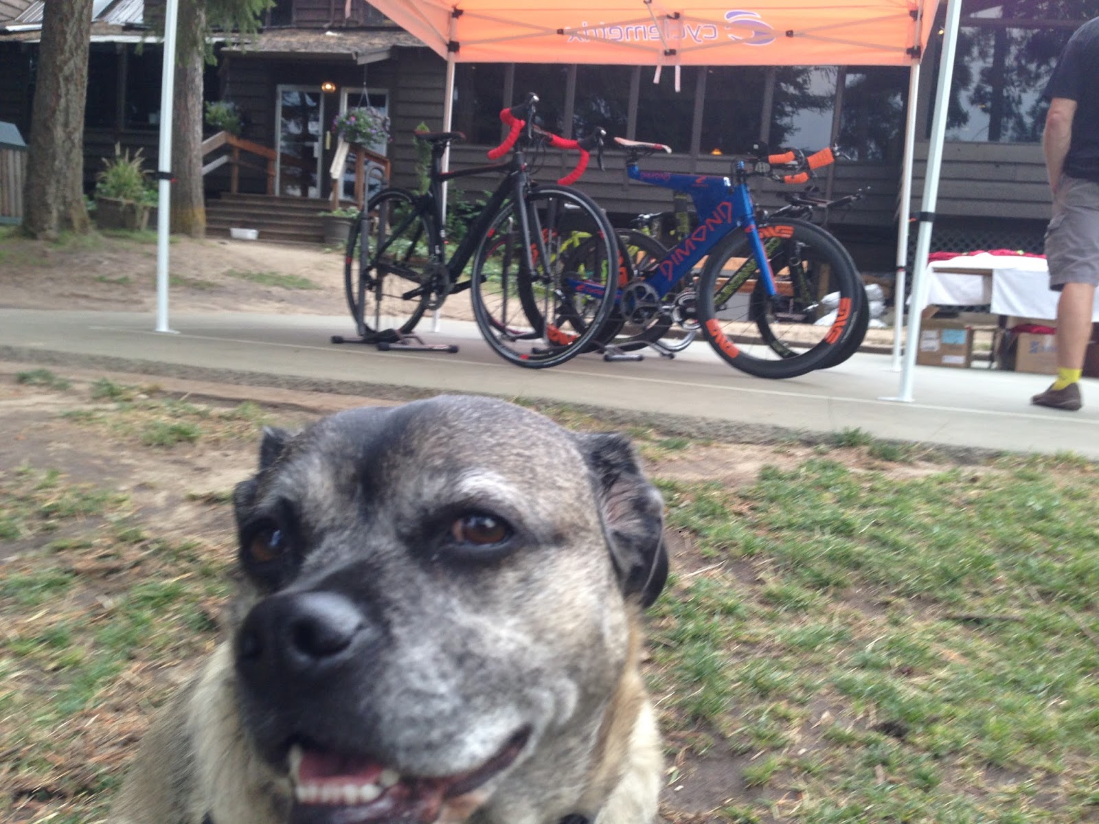
a great dog in front of an ugly blue/orange bike - late August at Priest Lake.  Debbie finished the Priest Lake Triathlon during the time of the forest fires nearby


Priest Lake in the morning - a surprisingly clear picture given the fires nearby. Hill's Resort.

I took the Fargo along and checked out the trails near the resort.  I was a bit nervous out in the woods by myself, wished I'd brought along bear spray.


did i already post this in one of my bike rack theme posts? at the blackbird


no lock? try the ol' hide your bike behind the planter trick

the trail between Joe Albi Stadium's back parking lot and the Cemetery. yup, i'm one of those dog walkers.  let the dogs get a little too far ahead of me, and they came across a bicyclist. luckily they were ok.  I've become more tolerant of loose dogs out on trails, still don't like them in the city. am going to take the bike with the dogs next time and see how that works out with these hellions.


my fargo out at riverside state park. OutThere monthly has a deal called backyard booty, where they hide some swag in the outdoors.  I found a feather...
and this..
 

scouting out a trail above aubrey white parkway, i was looking for a way to get from the merkel trail to the bowl and pitcher without riding on the road. not real feasible as far as i can tell. 


September - it was great to see lots of bikes at a nearby grade school

new bike lanes with a buffer zone going down on main ave. some cyclists hate them because they are to the left of parked cars, and they're not a separated, protected bike path with the cars on the left blah blah blah. i don't have any big beef with them - i think it's the most financially and politically feasible solution. not entirely sold on the separated paths for downtown, anyway.

i was looking for a good route from home to the future trader joe's at Franklin Park shopping center. found it'll be very easy - just head north to Rowan and take it east to Franklin Park. then either cross division on the other side of the park, or cross at central. anyway found this bike route sign at the end of rowan before the park. have not found the bike route it speaks of. interestingly, there's another one on the other side of the park at division and rowan.


double u-locking my vaya at holy family hospital (also near Franklin Park)

so, spokane has a sit-lie law which makes it illegal to sit or lie on the sidewalks downtown (unless you're camping out at the apple store, waiting for the new iphone). found out it's also illegal to sit on the planters on wall street, the so-called pedestrian plaza. i was hanging out after work, waiting for the city council meeting on the john wayne pioneer trail, when a police person approached me and advised me so. i took my time leaving. don't get me started on the smokers on wall street, some of them my co-workers.

exploring trails in the merkel/joe albi/cemetery ridge area.

more bike rack pics. this one at river ridge made out of pipes.
the huffy rides again. at walmart.

my favorite bike rack pic. if you look closely you'll see the little chain securing (ahem) the rack to the post. at rockwood eye clinic.

a bike light? from joann fabric store

more exploring trails or potential spots for trails in the merkel/albi/cemetery ridge area. have visions of more trails near and connecting to the merkel trail.


veterans day


the winter bike fleet: the marin muirwoods and pugsley neck romancer

after years of complaining, i finally finally broke down and got a longer seat post for the marin. the seat post bolt wasn't holding anymore so sorta had to. now for a new seat.

and now we are mostly up to date in wileydogland: saturday on the merkel trail. woo hoo!

Sunday, November 29, 2015

another black friday ride

Well, I didn't make it to the South Hill for THE Black Friday Ride.  But I did make it on TV: Community Opts Outside for a hike.  See the fatbiker towards the end.

Friday morning I wasn't sure if I was going anywhere, but then I told myself - I'm lucky enough to have the day off, I should take advantage of it.  Like my Mom used to tell us when we were kids "Go ouside and do something, you'll feel better."  So I saddled up the Pugsley Neck Romancer and headed out. I actually thought about bringing a Jetboil along and doing a little…gasp...coffeeneuring. With a little extra something from a flask.  But all I have for coffee making on the trail is the Jetboil and a Starbucks Via packet, so that didn't seem worth the trouble.

By the time I left around 9:30, I didn't think I would make it to the South Hill in time - I was also feeling slow and didn't want to hold up the gang on the trail - so instead I headed to Joe Albi stadium and the trail that begins behind the Ball & Dodd Funeral Home.  (I sometimes hold my breath as I pass by if I see smoke coming from the crematory.  Heck it's only smoke but kinda creepy.) Which is where I remembered I have an extra tube, and a patch kit but gosh I don't think I packed a pump.  Oh well, I threw caution to the wind and kept going.

The general plan was to take the Merkel Trail down the ridge, then to the Bowl and Pitcher, cross the river and go left/East on Trail 25 to Trail 100; cross TJ Meenach Drive to the forbidden trail that winds along the river passing below the MegaChurch/Housing Development and the Government Way Cemetery, then to Vinegar Flats. Maybe run into the riders starting from the South Hill.  Follow along at the Garmin map here.  Contrary to my nature, I pretty much stuck to the plan.

I got to the Bowl and Pitcher campground and saw a Ranger talking to a group of people and remembered reading something about a guided hike at Riverside in the paper.  I head to the bridge and saw what looked liked a TV cameraman on the other end filming the river.  When he saw me, he swung the camera off the railing down to the ground to catch me as I rode by.  Now, you're supposed to walk your bike across the bridge, which I usually do.  But the camera guy was ready, and probably wasn't hoping for a shot of me walking my bike, so I obliged and road across. After I rode by him, I realized he swung the camera around and was following me heading up the stairs, so I tried to step sprightly and make it look easy carrying a 30+ lb bike up the stairs. That's how I ended up on local news, a shining example of people opting out of Black Friday shopping madness.

On the other side:

It's great that bikes are now allowed to turn left (to the right in the above pic) onto Trail 25.  It's extremely rocky and unrideable at first, but the ground evens out after awhile.  I connected to Trail 100 and saw the section we worked on last summer was holding up nicely.  I met a group of hikers and couple mountain bikers, but otherwise had the trails to myself.  Saw other fat tire tracks in the snow, too.

At the end of Trail 100, I crossed TJ Meenach Dr and entered the Forbidden Trail. Passed that old bridge.


By around 11:00 a.m., I was below the Housing Development/Megachurch off Gov't Hwy. Decided I don't really like riding most of this section. A lot of stopping or putting a foot down to stay upright.  Then onto below the Riverside Memorial Park (googled it and found it began in 1907 as Riverside Park Company, not as a cemetery. Who knew).

I kept seeing a couple mountain bike tire tracks. The South Hill gang might be coming from the other direction along this trail, but I figured it was too soon for these to be their tracks.

The trail climbs up to the cemetery, and then you ride along the edge for a bit.  I couldn't quite remember how to get down to Latah Creek, but luckily the 2 mountain bike tracks showed me the way.  Here's the spot:


I hung around the parking area by the Sandifur Bridge for a bit, drinking some water and eating a bit. Mmm, Trader Joe's Peanut Butter and Oat bars, my favorite.  Then I rode southish along the east side of Latah Creek to the bridge at 11th Ave, then rode back on the other side of the creek. I considered riding further in the reverse direction of the other BF Ride, but figured this might be far enough.

Back at the parking area for the Sandifur Bridge, I considered heading back the way I came, but decided that's boring.  So crossed the Spokane River on the bridge and took the Centennial Trail to Pettet Dr, down Pettit partway to that trail off to the right and and up to NW Blvd. I missed the trail that leads back down to Pettet/TJ Meenach Dr, so I rode down TJ Meenach on the sidewalk against traffic.  Found the trail and rode/walked up it to where it connects with the trail, and then went back down.

These are all boring little details, but what I wanted to do was find a way from the dirt trails above Pettet, cross TJ Meenach Dr, then connect to the trails above Downriver Dr., riding as much dirt as I could on the way home. So I took the road under the bridge and then after the intersection, hopped onto a trail heading up the hill. I've only ridden these trails a few times, and ran into what looked like an old railroad bed - maybe part of the same line as the trail above Pettet.


I followed it for a bit and took a single track trail, ending up on a hill between two fairways of the Downriver Golf Course.  I thought I could see remnants of the rail bed below.  If that's what it is.

I tried taking a trail down, but it petered out and I headed back up.  Looked like it was heading to another fairway anyway.  I finally came to a dead end into another fairway and couldn't go any further without riding on the course.  I'm not sure if the below pic is the deadend now, or if at this spot I rode a bit more on a trail just off the course. Probably not a good place to ride during golfing season!


I spent a bit of time on the trails farting around and exploring. Eventually, I backtracked, went past the course's water reclamation area (at the end of the driving range I think), and found a trail up to Ridgeview Dr.  And then home a mile or two on the street.

Now I'm hoping we get more snow this winter, and see how theses trails are in deeper snow.

Thursday, November 26, 2015

City Hills #1

The September issue of OutThere Monthly had an article 10 Spokane-Area Hills to Climb Before You Die.  These are all climbs of at least a mile long, on paved roads located in and out of the city.  This got me thinking about the shorter hills in town off my commute and other longer unpaved climbs I like to tackle.  Hills like Monroe and Post Streets, Downriver, Houston Road, Idaho Rd.  Paved and gravel.  The idea was to ride more of these hills on my way home and build some strength.  And document them with distance and grade.

Well that didn't last long, but I did manage to garmanize two short hills. The first is the winding path from the Sandifur Bridge by People's Park to the Centennial Trail.   You may check the stats at The Sandifur Bridge Hill.  It's a whopping .34 miles long with a 98' elevation gain.  I believe the grade topped out around 8%.  A good little climb.

the view from the bottom

from the top
I really need to ride this a couple times each whenever i ride by it.

The next one I usually ride by on my way home is the hill down to the Sans Souci West  modular home park, former site of the Natatorium Park.  For years, when I ride by it with Debbie I joke that we should bike down it.  I'm so funny.  She always says go for it.  She'll be waiting for me.

at Boone and Summit Blvd
I finally took the plunge the same day as the Sandifur hill above. See garmin at Sans Souci Hill.  Another whopper at .41 miles and 89' elevation gain.  This one, though, is steeper than Sandifur - if I remember right it tops out at 10% grade. A good workout.  I couldn't make it all the way to the bottom, as Sans Souci West is signed for residents only.

Edition # 2 of City Hills should appear within the next 12 months.  I took a ride down the trail from Browne's Addition (3rd Ave/Couer d'Alene St.) to the river a while back.  Did not ride it back up, though.  Next I need to ride Houston Rd again and save the garmin stats for it, and then post these hills.


Saturday, November 21, 2015

Fargo All Road etc

As promised, here's another post I started and never finished. Maybe started it in June and worked on it in August. I tell you, sometimes it takes me a long time to get two coherent sentences together. Our cable and Internet is out due to spokane's recent windstorm - but we have power thank lob! - so I'm posting this from my smartyphone. Blogger informs it doesn't like my browser, so we'll see how this turns out. Any errors or omissions are solely my fault, as I haven't proofread this too closely. And it strays into bike geometry territory on which I have no clue. So here goes...

I ride my Fargo to work sometimes and I think the same thing each time - maybe smooth 2" tires are the best all around tire option.  The 2.2" Continental Race Kings smooth out the cracks and holes in the city streets, and I can ride home on the rocky single track trails better than I can on the Vaya's 700 x 40 tires.  They may be a little slower on pavement, but the ride is less jarring.

Well if you haven't noticed, there's been a minor explosion of interest in what's being termed "all road bikes" and there are a lot more options in the wide tire market.  I check out Off the Beaten Path blog from the folks at Bicycle Quarterly sometimes - I can only take it in small doses as it's mostly about randonneuring and what the editor Jan Heine terms high performance bikes (as opposed to racing bikes - there's a difference I guess) and frequent mention of wide, supple tires.  I'm all for tires wider than 23-28mm as I get embarrassed by bikers who look at a stretch of dirt or gravel and go yikes I can't ride my road bike on that! And then complain in public forums and make bikers look like wusses.  It's just too much sometimes.

Shoot where was I?

Oh yeah, Jan Heine had preferred 42mm (650B of course) wide tires for riding off pavement and felt he didn't need any wider than that.  I always wondered about that and figured he may not ride very rough roads or trails, as I prefer the 2"+ tires on the Fargo for deep gravel, rutted dirt roads and single track.  BQ did some experimenting, and he's changed his mind.   With the help of Panaracer, they had some knobby tires with extra light casings made, and then shaved off the knobs.  The results: off-pavement the "wider tires are simply amazing" and on pavement the rolling resistance is no higher than on narrower tires.

The good news is that Compass Bicycle, the component arm of BQ, will be offering these wide, supple tires.  See The Enduro Allroad Bike (oh boy another bike category for BikeSnob NYC to make fun of!). The bad news is they will be available only in 26 x 2.3/54mm and 650b x 48mm, but no 700c.  I'm not sure if I want that thin of a casing on those rocky, weedy trails around here anyway.

There's reasons for no 700c - something about short instead of long chain stays, road Q factor as opposed to mountain bike Q.  Something about a preferred road geo vs mtb because road is faster.  I like longer chain stays, and mtb Q factor doesn't bother me - I think the Vaya and Fargo have a wider Q, what with the mtb derailleur and gearing.

I could always convert the Fargo to 650b, but I'm cheap and maybe will some day search out some smoother 29" tires.  As commenters on the BQ blog pointed out, there are other brands that offer smooth tires.  Rawland is offering the Ravn with 26" wheels.  If you want 650b, you could of course get an Elephant National Forest Explorer, the better option.

Thanks for reading, and ride safe, far, and wide.


Monday, November 16, 2015

the John Wayne Trail - not just for fatbikes

Speaking of the JWPT, I saw on FB that a group was planning to ride fatbikes from Roslyn to Ellensburg for the 11/23 meeting.  Which is great - but it seems lately when biking on the trail is mentioned, it's fatbike-centric.  I can affirm - and maybe everybody knows this already - that you don't need a special bike to ride the trail. A regular old mountain or similar bike will do.

In fact, if I ride the trail next year, I'm planning on taking my Fargo, a drop bar bike with standard mountain bike tires, instead of that Pugs N/R. It's set up tubeless, and I've been wanting to take it on an extended trip.  Sure, when I rode with Pat from Tekoa to Ralston, I was envious at times of the ease with which the 4" tires on his bike rolled over the rocks compared to my MTB.  In some rocky sections, my handlebar was bouncing all over the place, but a lot of that was due to my stubborn refusal to lower the tire pressure much.  I think the tubeless set-up Fargo should work.

I don't think I'll make it to the meeting next Monday, but if I can, I'd like to ride the Fargo in part of the way.  I'm afraid it'll seem as if the people who bike the trail are a small sub-set with special bikes and not representative of all bike users of the trail.

Wait, small subset with special bikes - that pretty much describes Fargo owners. Oh well.


Saturday, November 7, 2015

The John Wayne Pioneer Trail uproar

One of our erstwhile state legislators, Joe Schmick, snuck in a provision into the budget to close the eastern Washington portion of the John Wayne Pioneer Trail.  He would've succeeded if he hadn't made a typo - it said it would be closed from the Columbia River to the Columbia instead of from the Columbia to Malden or wherever he wanted to close it.  

Pat at 26InchSlicks has posted a great op-ed piece by Ted Baszak of the Tekoa Trail and Trestle Association. The blog post is This and I took the liberty of copying and pasting below.  It explains the situation and the pros and cons of the trail.

I trust this Schmick guy about as far as I can throw my fat bike. I live in District 3, so I'll be contacting my district legislators Sen. Andy Billig, Reps. Marcus Riccelli and Timm Orsmby.  Heck, it probably won't hurt to contact the other Spokane area legislators: District 4 Sen. Mike Padden, Reps. Bob McCaslin and Matt Shea; District 6 Sen. Michael Baumgartner, Reps. Kevin Parker and Jeff Holy.

From Ted Baszak, of the Tekoa Trail and Trestle Association, who is pouring every ounce of his personal energy into this issue, and who has become a major voice in the dialogue.  WORD . . .

Here's an OPED piece I wrote this week, it's very current to where we are at and tells the whole story. Please share it or get it on whatever blog or other media sources you can, thanks, Save The Trail!!

What will Representative Joe Schmick now do with Washington’s only state wide trail? Will he close it forever? Will he repair it for all? Or will he simply do nothing?

By Ted Blaszak, member of the Tekoa City Council and President of the Tekoa Trail and Trestle Association tekoatrailandtrestle@gmail.com on Face book at the Tekoa Trail & Trestle Association

“Schmick is noncommittal about whether he will try again to close the trail. “We’ll hear from everyone at the meetings,” Capital Press Nov 4th 2015.
During the final budget conferences of the 2015 legislative session, behind closed doors, Representative Schmick (9th Colfax) placed into the capitol budget a proviso that took 135 miles of the John Wayne Trail, 6,000 acres of park land, and gave it away, at no cost, to 200 adjacent property owners. It was a land grab done without any public announcement or input.

When asked later why he made such a definitive move as to close the state wide trail forever in the shadows of secrecy rather than the openness of democracy, he said he did not want to waste his fellow legislators’ time by having a hearing for such a trivial matter. And when asked why he did not bother to inform his own constituents, of which many are trail users, he said that we could go look it up on line if we wanted to. You may find it on line if you read the Capitol Budget very carefully, it is in section 3121(3) on page 118 of the 280 page document.

It is the fundamental basic duty of any legislator to both inform and listen their constituents; all of them not just a particular group of supporters. They are to be our ears and voice in Olympia. Rep. Schmick has failed to fulfil this basic duty of his office, but there may still be time to repair the damage. 
Despite his best efforts to decimate the trail, Rep. Schmick met a road block, in the form of a simple typo. The proviso incorrectly named the points of the trail to be closed, thus nullifying the law enacted when the budget passed. For now, the trail remains open.

If you have never visited the John Wayne Trail, please do, you’ll enjoy it. It is the largest rail to trail conversion in the nation, one of only two cross state trails in America, it’s over 280 miles long. Starting just south east of Seattle, you can bike, ride a horse, or hike all the way to the Idaho border on an isolated path shut to motorized vehicles. It begins in thick wood lands rich with lakes and rivers, then through the dramatic and harsh terrain of the scab lands, and ends in some of the most peaceful pastoral settings our state has to offer. Every mile is solemnly tranquil and offers dramatic vistas.

It is used by thousands annually, including horse riders, hikers, cross country bicyclists, the Boy Scouts of America, The John Wayne Pioneer Trail Riders, and many more.

It is also one of the very few places where you can see the scab lands, a terrain so rare geologically it exist only by the John Wayne Trail and on the planet Mars. Young Washington geologists travel to the trail every year for their training. And rich with the cultural heritage of our state. Just this past weekend the Ralston Grange restored an old rail way station that is on the trail.

Most importantly to me, it ends in my small town of Tekoa WA (pop. 843). You pass a large sign as you enter Tekoa “Welcome to the End of the John Wayne Trail”. It’s important to our identity and our economy. Rep. Schmick must have past that sign on his way to be in our town parade this July.
It’s hard for a small town to stand up to a powerful state legislator but that’s what we did.

We learned about this tragedy in September. While attending the Palouse Empire Fair, where my daughter was showing her 4H sheep “Spot”, I stopped by Rep. Schmick’s booth and asked him if he got the trestle cookies my wife Debra baked and mailed him. I wanted to thank him for his support for our efforts to get funding for the Tekoa Trestle. He said he would support that end of the trail, but planned to reintroduce legislation to close the trail from the Columbia River to Malden. This of course was quite shocking news. Until this moment that information was known only to a handful of people.

Two days later, and after our Mayor John Jaeger spoke with Rep. Schmick, our city council passed a resolution asking that the trail be kept open and better funded instead. Since then there has been something of an uproar in the Palouse. Lots of news articles, emergency town meetings, and a supporting resolution from the City of Spokane.

In all fairness, during my conversation with Rep. Schmick, he made some very good points regarding his motivations for closing the trail. Adjacent land owners have had to endure some real problems. For example, the State has neglected fence lines, noxious weed control, and have recently imposed upon farmers a fee for using the trail to transport equipment.

Recently we met with Rep. Schmick and he agreed to hold with the Tekoa Trail and Trestle Association three meetings along the trail to solicit public comment. The meetings will all take place in November so that at their conclusion there is time available for Rep. Schmick to introduce legislation for the 2016 session to address the needs of the trail.

Public Comment Meetings for the John Wayne Trail

Rosalia Tuesday November 10th 12pm 
Community Center (7th St. and Whitman Ave.)

Lind Monday November 16th 12pm 
Union Elevator Conference Room (201 S street)

Ellensburg Monday November 23rd 6pm 
Hal Holmes Center (209 N Ruby St.)

Those unable to attend may email in their concerns to JWTcomments@gmail.com

At these meeting the TTTA will be advocating for 11 key points as the basis for a bill to solve the problems of the John Wayne trail for landowners and trail users alike:
1. improve spraying for noxious weeds
2. reinstate ranger service 
3. repair the cow creek trestle 
4. remove permit requirements for recreationalists 
5. remove fees for farmers moving equipment on the trail
6. restore the Tekoa trestle 
7. start a citizen litter patrol “adopt the trail program”
8. repair the Columbia River Crossing
9. improve rock slide removal and gravel grading
10. proper fences installed and maintained
11. additional trail heads, water stations and bathrooms installed

We hope that at the conclusion of these meetings Rep Schmcik will not introduce legislation to close the trail but will instead seek the sufficient funding necessary to repair it and protect land owners.

To close the trail would be a tragic permanent loss to our state and our small town. To do nothing at all will only exasperate the sufferings of adjacent landowners. The best path forward is to repair the trail.

There are many who will object to the expenditure of any money spent on such projects. I ask they not allow their well-placed conservative values to relegate Eastern WA to second class citizenry. West of the Columbia River the trail is in pristine condition, trail heads, weeds sprayed, maintained fences, finished trestles and ranger patrols. There are no complaints from nearby landowners there. It is only here in Eastern WA that the trail needs to be refurbished. We seek no new taxes but the same type of support for our end of the state wide trail.
The future of our state’s trail is now in the hands of one man. What will our Representive do? I don’t have any idea. But I wish our town was not so dependent upon the good will of one man who has not demonstrated a history of support for the trail.

If you are a Washington citizen in support of our trail please come to our meetings, we need you. If you are a city councilor please help us by passing a similar resolution to Tekoa and Spokane’s. And if you are member of the Washington State legislature please do whatever you can to help us save the trail.